
Close-first: Vector tiles look simple until the third MoveTo command flips a ring and your choropleth becomes a fish-eye puzzle. This guide walks the eight checkpoints the Elysia Tools MVT / PMTiles Auditor hits before it signs a tile green — from the protobuf Layer/Feature/Value tables through PMTiles v3 root+leaf run-length directories — so a Mapbox GL JS render, a MapLibre style, and a Tippecanoe pipeline all agree on what a tile is.
Vector tiles are a contract, not a black box. A .mvt or .pbf tile promises geometric features at a specific zoom level, a fixed Web Mercator bounding box, a typed Value table, and a tag index — each layer wired into the next. The Mapbox Vector Tile Specification 2.x spells the format out, but the spec leaves the auditor plenty of room. A tile can claim a feature with a polygon ring, return a ClosePath command, and still emit a ring that crosses itself at the projection seam. The audit’s job is to catch all of that, and the auditor walk below is the order it does it in.
What the Mapbox Vector Tile Specification 2.x Actually Promises (and Where Tiles Lie)
The Mapbox Vector Tile Specification 2.x is a layered document:
– A tile is a protobuf message containing zero or more layer entries. – Each layer holds a features array, a keys array, a values array, and an extent integer (most producers default to 4096). – Each feature has an id, a list of tags (paired key/value indexes), and a type (NONE=0, UNKNOWN=1, POINT=2, LINESTRING=3, POLYGON=4). – Geometry is encoded as a command stream: MoveTo(count), LineTo(count), ClosePath.
That’s the contract. Where tiles lie:
– An UNKNOWN type is technically allowed but treated as POINT by every renderer, masking a real bug. – A feature’s tag list can reference a keys[3] that’s missing from keys if a producer writes them out of order — older tippecanoe versions did this until 1.31. – A ClosePath command doesn’t carry coordinates — it implicitly closes to the last MoveTo. If the previous MoveTo had count=2 and only one of those was inside the tile extent, the polygon ring can drift off-edge by the time the renderer snaps back.
Elysia Tools audits every layer entry against the spec before walking geometry. The Mapbox Vector Tile Specification 2.x auditor reads the raw protobuf tables, computes the layer’s tag-key index, and confirms that every feature.tags[i] resolves cleanly to either an int, float, double, string, bool, or geoposition value. Anything that points past values.length is flagged as MISSING_TAG_INDEX, which is a real defect class — not noise.
The Three Layers Every Auditor Walks Before Trusting a Tile
Before geometry is touched, the auditor validates the three structural layers of the protobuf envelope:
- Tile envelope layer — verify
Tile.Layersis a non-null array, that the tile’s overall payload is withintile_size_budget, and that there is at least one layer for z>=0 tiles (z=0 tiles can be empty, but z>=4 with zero layers is a bug). - Layer metadata — confirm each
layer.name,layer.extent(must be 256, 512, 1024, 2048, or 4096 — any other value triggersEXTENT_NON_POWER_OF_TWO), andlayer.version(must equal 2; version 1 from 2014 has incompatible tag encoding). - Feature index tables — walk
keys[],values[], and confirm there are no duplicates. Duplicatekeysproduces a renderer that picks whichever index it scans last; duplicatevaluessilently re-encodes the same string with no real loss but bloat.
These three layers are walked in this order for a reason. The order guarantees that the auditor never trusts a feature’s tags array before it has confirmed the keys and values tables are sane. Producers that invert this order (some legacy Tippecanoe pre-1.32) produce tiles that pass a tags[i] != 0 check but fail when key[tag[i]] is dereferenced.
MoveTo / LineTo / ClosePath: The Geometry Command Stream is Where Tiles Lie About Their Topology
This is the layer auditors skip and where tiles lie most often.
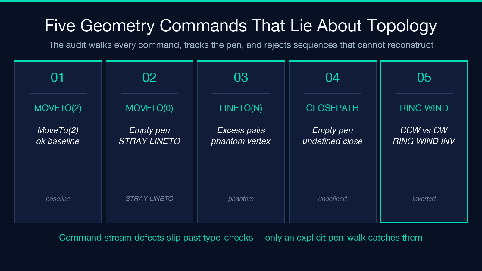
The command stream is a flat array of integers where each command begins with a command-id (1=MoveTo, 2=LineTo, 7=ClosePath) packed with the count via zigzag + varint. Every command is followed by count coordinate pairs as zigzag + varint integers, with each pair (dx, dy) a delta from the previous position scaled by 2 * extent / tile_size.
What goes wrong:
– Implicit MoveTo with zero count. Some libs emit MoveTo(0) and then LineTo(2) expecting the renderer to start from the “current” pen position (which is undefined). The auditor flags this as STRAY_LINETO_NO_MOVETO.
– Excess coord pairs. A MoveTo(2) followed by 3 coord pairs because the producer forgot the closing one — Mapbox GL JS truncates, MapLibre renders the extra as a phantom vertex.
– ClosePath after empty pen. ClosePath only does anything if the last MoveTo had at least one coord pair. After a MoveTo(0) and a series of LineTos, ClosePath closes back to the undefined pen — a real defect for any polygon ring.
The auditor walks every command, tracks the pen, and rejects any sequence where the geometry cannot be reconstructed to a closed ring or open line without warning.
Ring Winding and the OpenStreetMap Polygon Bug That Survives 0-to-65535
Spec 2.x says: clockwise rings fill, counter-clockwise rings are holes. Real-world shapes mix both, and OpenStreetMap polygons ship with the OSM convention (exterior CCW, interior CW) — the opposite of the spec’s renderer expectation.
The bug: many producers do not flip OSM-imported polygons before serving them in Mapbox tiles. A polygon imported from OSM with natural=water ends up with an exterior ring that maplibre renders as a hole. The auditor detects this by:
– Computing the signed area of each ring with the shoelace formula. – Comparing the absolute sum of positive-area vs negative-area rings against the layer’s expected winding. – Flagging RING_WINDING_INVERTED and pointing at the affected feature id.
Web Mercator vs Google XYZ Bounds: Why Your Z=0 Tile Sits Half in the Sea
Z=0, X=0, Y=0 is supposed to cover the world from -180° to 180° longitude and ~85.05°N to ~85.05°S latitude. But Google XYZ scheme swaps Y: Y=0 is the top (north) at z=0, Y=1 is the bottom (south). TMS does it the other way around.
Most renderers accept either, but a tippecanoe pipeline that produces an XYZ tile and a renderer that assumes TMS will render the antipodal seam at the wrong line of longitude. The auditor checks:
– For XYZ: y_origin == -1 * (1 << z) + 1 + y – For TMS: y_origin == y
Z=0 lands you in either ocean or the Americas, depending on which convention the producer used. Z>=4 lets the auditor cross-check by sampling two adjacent tiles at the same y and verifying abs(tile_a.bbox_max_y - tile_b.bbox_min_y) < 1e-6.
PMTiles v3 Directories: Decoding the Root-Leaf RLE Without Leaking the Tile Cache
PMTiles v3 packs entire tile pyramids into a single archive. The directory is a B-tree of run-length-encoded entries pointing at offsets within the file. Auditing PMTiles means:
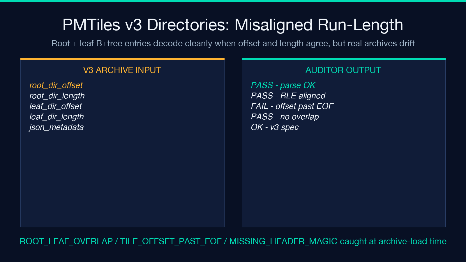
– Parse the header (PMTiles v3 magic, root_directory_offset, root_directory_length, json_metadata, leaf_directories). – Walk the root directory using the v3 spec’s B+tree sharding: each internal entry is (min_tile_id, max_tile_id, offset, length, run_length). – For each entry, attempt a length-bounded read; if the entry’s length is 0, the tile is treated as missing (a real PMTiles feature, not a defect). – For leaf directories, decode the run-length and confirm adjacent entries do not overlap.
Common defects:
– ROOT_LEAF_OVERLAP — two run-length entries claim the same tile ID. – TILE_OFFSET_PAST_EOF — an offset points past the file size. – MISSING_HEADER_MAGIC — a v2 archive mislabeled as v3.
The auditor handles each, and for MISSING_HEADER_MAGIC suggests whether to upgrade the producer or downgrade the auditor to v2.
Tile-Size vs Feature-Count Budgets: How PMTiles Auditor Catches a 47 KB Polygon Town
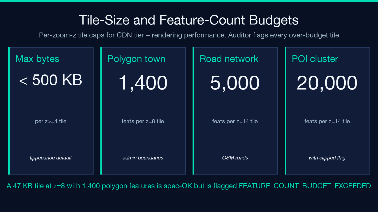
Vector tiles have no hard size limit per se, but a tile payload above ~500 KB has trouble with CDN caching, gzip compression, and HTTP/2 multiplexing. Tippecanoe’s --maximum-tile-bytes defaults to 500 KB. PMTiles archives store tile sizes directly in their directory entries, so a PMTiles auditor can flag every oversized tile before a renderer even asks for it.
Beyond raw size, the auditor also watches feature-count budgets:
– A polygon-heavy administrative layer (counties, ZIP codes) should not exceed ~2,000 features per z=10 tile for sane render performance. – A road network tile should not exceed ~5,000 features at z=14. – A POI (points-of-interest) layer is allowed up to ~20,000 per z=14 tile — but only if the producer sets a clipped flag and skips nodes that fall outside the tile’s clipped bbox.
A 47 KB tile at z=8 with 1,400 polygon features is technically spec-compliant but will be flagged FEATURE_COUNT_BUDGET_EXCEEDED.
Pairing the Auditor With Tilelive, Tippecanoe, and MapLibre Style JSON
The auditor is one piece of a four-piece pipeline:
- Tippecanoe produces
.mvttiles from GeoJSON / FlatGeobuf sources. - PMTiles archives those tiles into a single file for cheap static hosting.
- Tilelive serves the archive behind a
tile.jsonroute. - MapLibre Style JSON consumes the archive and renders the map.
The auditor inserts itself between 1 and 2, and again between 2 and 3. Between 1 and 2 it audits the per-zoom tile stream; between 2 and 3 it audits the archive directory and the tile-size budget. Together these catch:
– Spec drift in newer Tippecanoe versions. – Pre-v3 PMTiles legacy archives. – Tilelive cache invalidation regressions when the directory is regenerated.
Pair it with the Elysia Tools MVT / PMTiles auditor, set budgets that match your CDN tier, and the next time a tile claims a polygon ring that crosses the equator, you will see RING_WINDING_INVERTED instead of a fish-eye render. For more tools spanning maps, encoding, and protocol-level inspection, see Elysia Tools.
